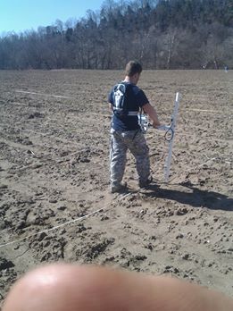
ETSU Geosciences Department conducts a survey. This gives us a modified look below the surface to find housing structures, pit features, or central hearths. We are currently awaiting the results

And these are some of the results, off a small grid area, displaying 3-5 housing structures and various potential pit features. This image is copyrighted and edited for public consumption only


This is an amazing blog so; great to find it! As a Bristol resident, I’ve really been interested in the Chiscas and I’ve been voraciously consuming as much data as I can as well as making excursions to try to understand the reality of mid 16th century NE TN and SW VA. Here’s a map I threw together with my current understanding of the Chisca “empire” (completely unverifiable and unscientific in every way imaginable) http://i.imgur.com/xuJDcMC.jpg
I believe the border towns may have been Saltville, Long Island, Atkins, Damascus, and Hampton. Saltville in particular is an excellent fortified position and I think all the Tazewell goings-ons were a different tribe.To the West, the Chiaha and the Chisca may have had a fairly stable relationship based on meeting up in Kingsport for trading salt, etc. I’ve no idea what the status of the Watauga river was, but I do think there was a lot of border activity there with NC tribes.
For reasons I cannot explain, I believe the tribe cultures in our area agreed to “Waters” as their scope of influence. The Chisca “waters” might have looked like this: http://i.imgur.com/qJ9iall.jpg – I think the rivers and streams defined everything.
Thanks for writing this and I can’t wait to read more!
Ben thanks for the follow up. The only way to isolate the Chiscas will be through pottery types and looking at those similarities and differences off many of the Late Mississippian village/town sites in Saltville (and surrounding areas). Another important idea is to compare those characteristics to the SWVA mound complexes that are already established by Mareen Myers of Ole Miss in Lee and Scott Counties, get some radio carbon dates and see what we’ve got. Is the Saltville area a continuation of these mound networks but perhaps without a mound, yet linked by the trade of salt and other precious commodities of the time? This is a good place of reference:
https://olemiss.academia.edu/MaureenEMeyers
Your map of the chisca area could be correct, so little is known of the Chiscas at this present time, but to me it’s a tad too far south. Once you enter the Watauga regions the pottery becomes different, with much more inclusions of soapstone temper which is more defined by influences of the Joara area. It’s a little further complicated when comparing extreme Western SWVA (LEE/SCOTT) to Eastern SWVA (Washington, Smyth) because it would appear that Western SWVA tribes were beginning to abandon SWVA surprisingly early. The Mendota area is about as far Northwest as my pottery sample size extends so I’d love to start getting looks of pottery in the Abingdon, Bristol, Saltville areas at some point in the future. -Nate
(James Earl Jones Voice): Sherman. This is your father. Use the force. Use the force that is within you, and contact me at orari14@gmail .com. I need to talk archaeology.